 公司简介
公司简介-
System Overview
The LeadEx EWS-Early Warning System is a comprehensive system including the software platform, hardware, control console and accessories. It is ideal for large area surveillance applications, including the airport, border security, military base, harbors, defense security and perimeter protection systems.
Software
1.Basic configuration
1>Target Acquisition and Tracking
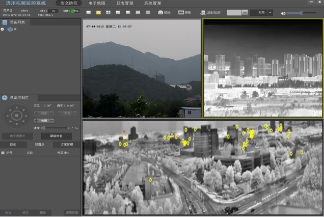
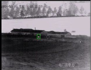
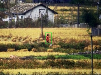
In the field of view, operators could acquire and lock a suspicious target by blocking it with mouse, and start the auto tracking. Then the optical system will follow up the movement of the interested target automatically, and show the history track if required.
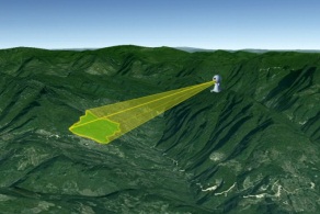
2> Absolute Positioning (GIS)
The software platform can calculate the target location of coordinates, latitude and longitude, altitude, etc., through the DEM location algorithm, meanwhile marking the target position in the electronic map.
3> Video Behavior Analyzing)
System could make behavior and motion analyzing for intrusion detection, retrograde, remnants, way out of range, directional crossing, and so on.
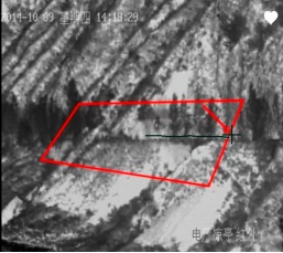
a.Intrusion function: to detect whether a target is entering the predetermined area; customized settings to support a regional basis, can be any shape, size rectangular or irregular shapes;
b. One way crossing alarm function: to detect whether a target is crossing the border ( a line in the map) from one pre-setup direction;
c. Two-way crossing alarm functions: to detect whether a target is crossing the border ( a line in the map) from either directions.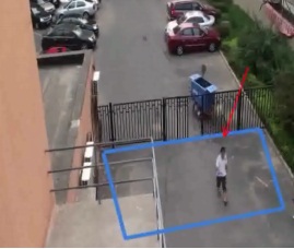
 Intrusion Detection Diagram
 Retrograde Detection schematic Remnants Detection
4> 3F (Full-FOV-Fusion)
3F (Full-FOV-Fusion) 3F is called Full-FOV-Fusion, which is an important function to give users a strong sense of the whole scene.
The platform could control the LeadEx PowerView System to make a full-field of view scanning, save and combine the multiple images as one image, so that the users know exactly the relative location of a viewing area or target in the whole field of view.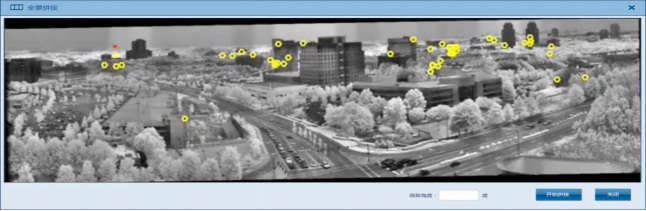 Full-FOV-FUSION of Thermal Image
 Full-FOV-FUSION of Thermal Image
 Full-FOV-FUSION of Day/Night Camera
5> GIS Map-in-map
3F (Full-FOV-Fusion) A small map shows the current possible field of view of the optical equipment. And a bigger map to show the relative location and area of the small maps, with GIS locations of both equipment and target.
Map should be supplied by End User.
6> Distance and Area Measurement
In the software, it can measurement each square size and distance as below map shows, Also that can shows the electronic optical system installation height, latitude and longitude...etc.
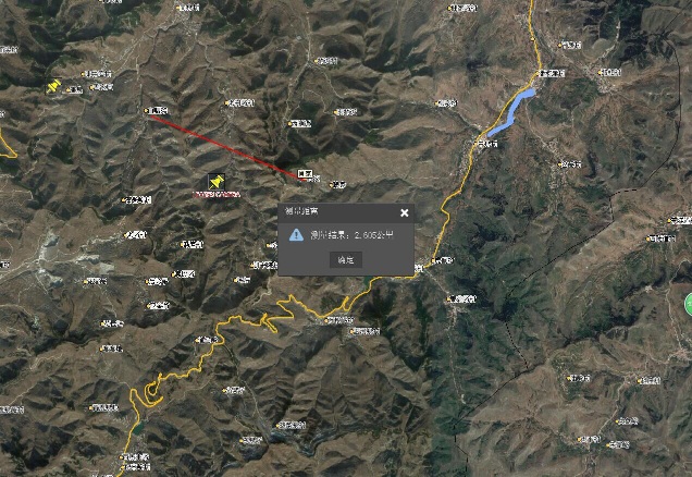 Target Distance (Three dimensional Map Optional)
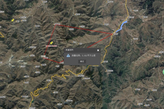 Square measurement (Three dimensional Map Optional)
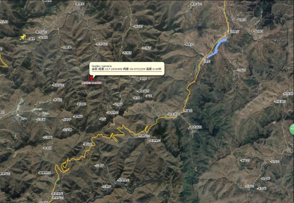 Electronic Optical System Position
Optional Functions
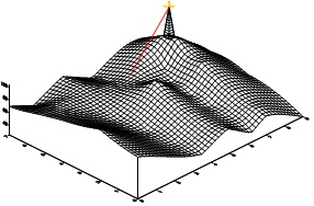
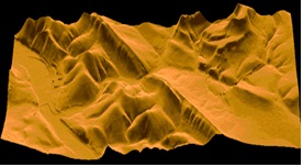
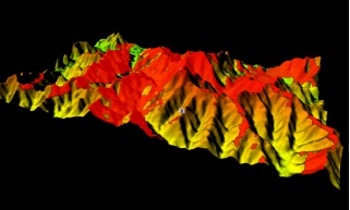
1> Three-Dimensional Map
Including three-dimensional map display of the altitude and geographic information.
 Spatial measuremen Trend show
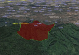
 Three-dimensional measurement Spatial analysis 2> Radar Software
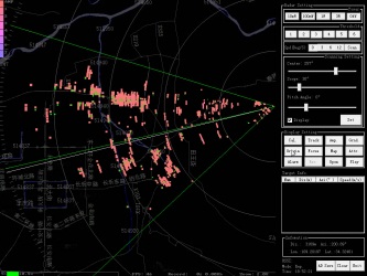
2> Radar Software
3> Perimeter Protection
4> Hot Temperature Alarm
5> Image Stabilization
6> Laser Range Finder
7> Satellite Interface

Copyright © 2003-2025 深圳市利达斯探测设备有限公司 版权所有